
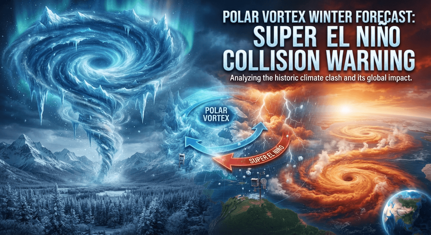
Breaking weather update! Read the Polar Vortex winter forecast breakdown as Super El Niño models point to major winter shifts across North America and Europe.
The upcoming season brings a unique atmospheric challenge for the United States. Meteorologists are closely watching a potential collision between a Super El Niño event and the shifting Arctic circulation patterns.
This interaction creates significant uncertainty regarding our seasonal outlook. While many people worry about extreme cold, it is vital to distinguish between broad climate signals and specific storm predictions. Unusual ocean temperatures do not guarantee a single nationwide outcome.

Instead, we must prepare for a complex mix of regional weather hazards. Residents should remain alert for potential Arctic outbreaks, heavy snow, and sharp temperature contrasts across the country.
Understanding the polar vortex winter forecast helps communities stay ready for shifting conditions. By tracking these large-scale drivers, we can better anticipate the risks of ice and strong winds in the months ahead.
Key Takeaways
- Super El Niño conditions significantly influence global climate patterns.
- The interaction with Arctic air creates high uncertainty for seasonal trends.
- Broad climate signals do not equate to specific daily storm predictions.
- Regional temperature contrasts are likely throughout the United States.
- Preparation for ice, snow, and wind remains essential for public safety.
What a Super El Niño Collision Could Mean for the United States
Analyzing the collision between a strong El Niño and the polar vortex is essential for predicting this season’s climate risks. This polar vortex impact analysis helps experts understand how distant ocean temperatures can dictate local weather outcomes across the United States.
Defining Super El Niño and Polar Vortex Conditions
A Super El Niño occurs when sea surface temperatures in the tropical Pacific rise significantly above average levels. This massive release of heat acts as a global climate driver, shifting traditional weather patterns worldwide.
In contrast, the polar vortex is a large area of low pressure and cold air surrounding the Earth’s poles. During winter, this circulation typically stays confined to the Arctic, but it can occasionally weaken or shift, allowing frigid air to spill into lower latitudes.
Why Tropical Pacific Heat Can Influence the Jet Stream
The intense heat from the Pacific forces the atmosphere to adjust its wave patterns. These waves travel upward and outward, eventually pushing against the jet stream, which is the high-altitude river of air that guides storm systems.
“Atmospheric teleconnections allow a warming event in the tropics to exert a profound influence on the stability of the polar circulation thousands of miles away.”
When the jet stream becomes wavy due to this tropical influence, it can create persistent weather regimes. These regimes often dictate whether specific regions experience mild, wet, or dangerously cold conditions throughout the winter months.
| Climate Factor | Neutral Year | Super El Niño Year |
|---|---|---|
| Pacific SSTs | Average | Significantly Above Average |
| Jet Stream | Zonal/Stable | Wavy/Disrupted |
| Polar Vortex | Strong/Contained | Prone to Displacement |
How a Stratospheric Disruption Could Alter the Winter Pattern
A stratospheric disruption occurs when the polar vortex is pushed out of its typical position or split into smaller pieces. This event is often triggered by the energy waves mentioned earlier, which travel from the troposphere into the stratosphere.
Once the vortex is disrupted, the cold air that was previously trapped near the North Pole can descend toward the surface. This process is a critical component of any polar vortex impact analysis, as it directly correlates with sudden, extreme cold outbreaks in the United States.
Why the Collision Is a Potential Risk, Not a Guaranteed Outcome
While the potential for a major disruption exists, it is not a certainty. Local weather depends on a variety of factors, including snow cover, blocking high-pressure systems, and the specific track of individual storms.
Therefore, a polar vortex impact analysis must remain flexible. Meteorologists monitor these variables daily to determine if the atmospheric conditions will align to produce a significant winter event or if the impacts will remain localized.
Polar Vortex Winter Forecast: Key Signals to Watch
Understanding the behavior of the polar vortex is essential for any accurate cold front forecast. Meteorologists monitor several layers of the atmosphere to determine if frigid Arctic air will spill into the United States. By analyzing these complex patterns, experts can better anticipate significant shifts in seasonal weather.
Stratospheric Temperature Changes Above the North Pole
The stratosphere sits high above the weather we experience daily. When temperatures in this layer rise rapidly, it is known as a Sudden Stratospheric Warming event. This warming can disrupt the polar vortex, often forcing it to weaken or shift away from its typical position over the North Pole.
Polar Vortex Strength, Position, and Stability
A strong, stable vortex usually keeps cold air locked tightly in the Arctic circle. However, when the vortex becomes unstable, it may stretch or split into smaller pieces. This instability is a primary indicator that a cold front forecast might soon shift toward a more severe winter outlook for lower latitudes.
Jet Stream Waviness Across North America
The jet stream acts as a boundary between cold polar air and warmer tropical air. When this current becomes highly wavy, it creates deep troughs that allow frigid air to plunge southward. These large meanders are critical for identifying where and when extreme cold will impact specific regions.
Blocking High Pressure Over Greenland and the Arctic
High-pressure systems near Greenland often act as a roadblock for weather patterns. This phenomenon, known as atmospheric blocking, forces the jet stream to dip further south than usual. Such blocks are highly influential in sustaining cold outbreaks across the central and eastern United States.
How Forecasters Combine Atmospheric Signals
Forecasters rarely rely on a single data point to issue a cold front forecast. Instead, they integrate ensemble modeling with real-time observations of the stratosphere and troposphere. This multi-layered approach helps reduce uncertainty when predicting the timing and intensity of winter weather events.
| Atmospheric Signal | Primary Impact | Forecast Reliability |
|---|---|---|
| Stratospheric Warming | Vortex Disruption | Moderate to High |
| Jet Stream Waviness | Cold Air Transport | High |
| Greenland Blocking | Pattern Persistence | Moderate |
| Vortex Stability | Arctic Air Containment | High |
How a Sudden Stratospheric Warming Event Could Reshape Winter Weather
Understanding the complex mechanics of stratospheric warming is essential for any accurate extreme cold weather prediction. When temperatures in the stratosphere spike rapidly, the atmospheric pressure gradients that normally contain the polar vortex are disrupted. This process forces the atmosphere to reorganize, often leading to significant shifts in how winter weather manifests across the United States.
Displacement Versus Split of the Polar Vortex
A sudden stratospheric warming event typically forces the polar vortex to react in one of two distinct ways. In a displacement scenario, the entire vortex is pushed off the North Pole toward a specific region, such as Eurasia or North America. This shift creates a localized area of intense cold while leaving other regions relatively mild.
Alternatively, the vortex may undergo a split, where it divides into two or more distinct lobes. These lobes then drift independently, which can lead to multiple, simultaneous outbreaks of frigid air across different continents. The following table highlights the primary differences between these two atmospheric behaviors.
| Vortex Behavior | Primary Impact | Duration |
|---|---|---|
| Displacement | Localized extreme cold | Short to medium term |
| Split | Widespread, multi-region cold | Longer, complex recovery |
| Stable State | Contained Arctic air | Seasonal average |
How Cold Air Can Descend Into the Troposphere
The transition of cold air from the stratosphere down to the troposphere is a gradual, downward-propagating process. As the vortex weakens, the high-pressure anomalies at high altitudes begin to influence the jet stream below. This interaction effectively “pushes” the Arctic air mass toward the surface, where it can settle over populated regions.
“The coupling between the stratosphere and the troposphere is the ultimate wild card in seasonal forecasting, as it dictates the potential for sustained winter severity.” — Anonymous Meteorologist
The Delay Between Stratospheric Warming and Surface Impacts
One of the most critical aspects of an extreme cold weather prediction is recognizing the inherent time lag. Surface impacts rarely occur the moment the stratosphere begins to warm. Instead, there is often a delay of two to four weeks as the atmospheric energy slowly migrates downward.
This lag time is a crucial window for emergency managers and utility providers to prepare for potential energy grid stress. Because the signal takes time to manifest, forecasters must monitor the vertical structure of the atmosphere continuously. Relying on immediate surface data alone often leads to missed warnings regarding incoming cold waves.
Why Sudden Stratospheric Warming Does Not Guarantee Snow Everywhere
While stratospheric warming is a strong indicator of potential cold, it does not serve as a universal guarantee for heavy snow. An extreme cold weather prediction must also account for regional moisture availability and the specific positioning of storm tracks. If the air mass is extremely dry, the region may experience bitter, bone-chilling temperatures without any significant snowfall.
Furthermore, the exact path of the displaced vortex lobes determines which states face the highest risk. A slight shift in the jet stream can mean the difference between a blizzard and a dry, cold snap. Consequently, meteorologists analyze the interaction between these upper-level changes and local weather systems to provide the most reliable outlooks.
Regional Cold Risk From an Arctic Air Mass Movement
A massive arctic air mass movement often triggers a cascade of freezing conditions that vary significantly by region. As this dense, frigid air spills southward from the pole, the unique geography of the United States dictates how quickly temperatures will plummet in specific zones.

Northern Plains and Upper Midwest Freezing Temperatures Projection
The Northern Plains and Upper Midwest typically serve as the gateway for the coldest air. Residents in these areas should expect the sharpest initial drops as the arctic air mass movement pushes across the border. Sub-zero readings often become the standard rather than the exception during these events.
Northeast and Great Lakes Cold Front Forecast
The Great Lakes and Northeast regions often face repeated intrusions of cold air behind strong, persistent fronts. These areas experience a prolonged winter chill as the air mass interacts with the relatively warmer waters of the lakes. This interaction frequently leads to intense lake-effect snow squalls alongside the plummeting mercury.
Central and Southern States Vulnerable to Sharp Temperature Drops
While the South is accustomed to milder winters, it remains highly vulnerable to a sudden arctic air mass movement. When these systems penetrate deep into the heart of the country, the temperature contrast can be shocking. Infrastructure in these regions is often less prepared for the rapid transition to freezing conditions.
Pacific Northwest and Western Mountain Temperature Patterns
The Western United States experiences a more complex pattern due to the rugged mountain terrain. High elevations often trap cold air in valleys, creating localized pockets of extreme frost. Meanwhile, the Pacific Northwest may see a mix of freezing rain and snow as the arctic air clashes with moist maritime currents.
How Local Snow Cover Can Intensify Overnight Cooling
Snow cover acts as a powerful insulator for the ground, but it also reflects sunlight during the day. At night, this reflective surface allows heat to escape rapidly into the atmosphere. This process, known as radiational cooling, can cause temperatures to drop much lower than forecast in areas with fresh snowpack.
| Region | Primary Risk | Temperature Trend |
|---|---|---|
| Northern Plains | Extreme Wind Chill | Rapid Decline |
| Great Lakes | Heavy Snow/Ice | Persistent Cold |
| Southern States | Infrastructure Stress | Sharp Drop |
| Western Mountains | Valley Frost | Variable |
Winter Storm Threats From the El Niño and Polar Vortex Interaction
The collision of a strong El Niño and a disrupted polar vortex often dictates the severity of upcoming winter storms. This atmospheric alignment forces the jet stream into configurations that can funnel moisture deep into the heart of the United States. When these systems synchronize, the potential for high-impact weather events increases significantly across multiple regions.
Storm Tracks Along the Gulf Coast and Eastern Seaboard
During these events, the subtropical jet stream often becomes more active, steering storms across the southern tier of the country. These systems frequently track along the Gulf Coast before turning northward toward the Eastern Seaboard. This path allows storms to tap into abundant moisture from the Gulf of Mexico, leading to heavy precipitation as they encounter colder air moving down from the north.
Heavy Snow Potential in the Northeast and Great Lakes
As these moisture-rich systems move toward the Northeast and Great Lakes, they often collide with lingering Arctic air. A precise snow accumulation forecast becomes essential for residents in these regions to prepare for rapid, heavy snowfall. Forecasters must carefully monitor the thermal layers to determine if the precipitation will fall as heavy, wet snow or transition into a wintry mix.
Ice, Sleet, and Freezing Rain Across the Central United States
The Central United States often serves as the battleground where warm, moist air meets freezing surface temperatures. This interaction frequently results in significant ice accumulation, which can cripple power grids and make travel hazardous. Sleet and freezing rain are common threats in this region, as the shallow layer of cold air near the ground remains trapped against the terrain.
Blizzard Conditions, Coastal Flooding, and High Wind Risks
Intense storm systems can also generate powerful winds that lead to blizzard conditions in open areas. Along the coast, the combination of low pressure and strong onshore winds often triggers coastal flooding. These high-wind events can cause widespread power outages and structural damage, compounding the challenges posed by heavy snow or ice.
Why the Coldest Pattern Does Not Always Produce the Most Snow
It is a common misconception that the coldest temperatures always yield the highest snowfall totals. In reality, extremely cold Arctic air is often very dry, which limits the amount of moisture available for cloud formation. A reliable snow accumulation forecast must account for this moisture deficit, as the most significant snow events usually occur when temperatures are just below freezing rather than at extreme sub-zero levels.
| Weather Threat | Primary Region | Impact Level |
|---|---|---|
| Heavy Snow | Northeast/Great Lakes | High |
| Ice/Freezing Rain | Central United States | Critical |
| Coastal Flooding | Eastern Seaboard | Moderate to High |
| Blizzard Winds | Plains/Midwest | High |
Seasonal Timing for the Most Significant Winter Weather Risks
A comprehensive severe winter weather outlook depends on identifying key temporal patterns that influence the atmosphere. While winter spans several months, the risk of extreme cold and storm activity fluctuates based on the state of the polar vortex and broader climate drivers. Understanding these shifts helps residents and officials prepare for the most volatile periods of the season.

Early-Season Signals Before the Polar Vortex Becomes Vulnerable
During the late autumn and early winter, the atmosphere often remains in a state of transition. Forecasters look for specific indicators, such as the development of high-pressure blocking patterns over the North Atlantic or the Arctic. These early signals can suggest how stable the polar vortex will remain as the season progresses.
If the vortex shows signs of early instability, the risk of cold air spilling into the United States increases significantly. Early-season monitoring is vital for identifying whether the jet stream will remain locked in a stable position or begin to show signs of increased waviness.
Midwinter Risk During a Possible Stratospheric Disruption
The heart of winter is when the most significant atmospheric disruptions typically occur. A severe winter weather outlook often highlights this period because sudden stratospheric warming events are most likely to take place during these months. When the stratosphere warms rapidly, it can force the polar vortex to shift or split, sending frigid air toward lower latitudes.
These events do not always lead to immediate surface impacts, as the timing of the downward propagation varies. However, when the connection between the stratosphere and the troposphere is strong, the potential for widespread, long-duration cold outbreaks reaches its peak.
Late-Winter Pattern Changes as the Vortex Weakens Naturally
As the season moves toward spring, the polar vortex naturally begins to weaken due to increasing solar radiation. This transition can lead to complex weather patterns where cold air masses battle with warmer, moisture-rich air from the Pacific. A severe winter weather outlook must account for these late-season shifts, which often produce high-impact storms.
How Long Arctic Outbreaks May Persist After a Major Shift
When a major atmospheric shift occurs, the resulting Arctic outbreaks can linger for several days or even weeks. The duration of these cold events depends heavily on local factors like snow cover and the specific alignment of the jet stream. Persistent blocking patterns can trap cold air over a region, preventing milder air from moving in and extending the period of extreme temperatures.
Conversely, if the jet stream remains active and progressive, these cold snaps may be shorter in duration. Meteorologists analyze the interaction between these variables to determine how long a community might remain under the threat of freezing conditions.
How Arctic Air Mass Movement Could Affect Daily Life
The arrival of an Arctic air mass forces a rapid shift in how we manage energy, travel, and public safety. When a freezing temperatures projection is issued, the ripple effects touch nearly every aspect of modern American life. Understanding these impacts is essential for maintaining safety and operational continuity during extreme weather events.
Heating Demand and Energy Grid Stress
As temperatures plummet, the demand for electricity and natural gas spikes to record levels. Power grids often face significant strain as heating systems run continuously to combat the cold. This surge can lead to localized outages if the infrastructure is not prepared for the sudden load.
Transportation Disruptions From Snow and Ice
Winter weather creates hazardous conditions that complicate road, rail, and aviation operations. Snow accumulation and ice buildup on runways often lead to widespread flight cancellations and delays. Commuters must exercise extreme caution, as road surfaces become treacherous and visibility drops during heavy squalls.
Health Risks From Extreme Cold Weather
Prolonged exposure to subfreezing air poses severe risks to human health, including hypothermia and frostbite. Vulnerable populations, such as the elderly and those working outdoors, face the highest danger during these events. It is vital to limit time spent outside and ensure that living spaces remain adequately heated.
Agricultural, Water Supply, and Livestock Concerns
Farmers must take immediate action to protect sensitive crops and livestock from the biting cold. Water pipes are also at high risk of freezing and bursting, which can lead to costly property damage and supply interruptions. Proper insulation and emergency heating measures are necessary to safeguard both infrastructure and animals.
Communities Most Vulnerable to Prolonged Freezing Temperatures
Certain areas are more susceptible to a freezing temperatures projection due to aging infrastructure or limited resources. Residents in older homes with poor insulation often struggle to maintain safe indoor temperatures. Furthermore, communities lacking access to reliable backup power or emergency transportation services face the greatest risk during sustained cold spells.
| Sector | Primary Risk | Mitigation Strategy |
|---|---|---|
| Energy | Grid Overload | Reduce non-essential usage |
| Transportation | Hazardous Travel | Delay non-essential trips |
| Agriculture | Crop/Livestock Loss | Provide shelter and heat |
| Residential | Pipe Bursts | Insulate exposed plumbing |
Winter Storm Updates and Forecast Reliability
Reliable winter storm updates are the foundation of effective preparation for extreme cold and snow. As weather patterns shift, the ability to distinguish between long-range trends and immediate threats becomes vital for public safety.
What Seasonal Outlooks Can and Cannot Predict
Seasonal outlooks provide a broad perspective on potential climate trends, such as the influence of El Niño on regional temperatures. These reports are probabilistic, meaning they describe the likelihood of warmer or colder conditions rather than specific daily weather events.
They cannot predict the exact timing or intensity of individual snowstorms weeks in advance. Instead, they serve as a guide for long-term planning and resource allocation for local governments and utility providers.
When a Broad Pattern Becomes a Credible Storm Forecast
A broad atmospheric pattern transitions into a credible forecast as computer models begin to align on specific variables. Meteorologists look for consistency across multiple model runs to increase their confidence in a potential event.
When these models resolve the storm track and precipitation type, the quality of winter storm updates improves significantly. This shift usually occurs as the event draws closer, allowing for more precise regional impact assessments.
How to Use National Weather Service Advisories
The National Weather Service (NWS) issues official advisories to communicate specific hazards to the public. These products are designed to provide actionable information based on the latest meteorological data.
Residents should prioritize these official channels over social media speculation. Following NWS guidance ensures that you receive the most accurate and timely information regarding local weather threats.
Forecast Changes to Monitor During the Seven-Day Window
The seven-day window is a critical period where forecast accuracy typically increases. During this time, you should monitor changes in projected snowfall totals, wind speeds, and the expected timing of the storm.
Small shifts in the storm track can lead to significant differences in local impacts. Staying updated daily helps you adjust your plans as the situation evolves.
Distinguishing a Severe Winter Weather Outlook From a Specific Warning
It is important to understand the difference between an outlook and a warning. An outlook indicates that conditions are favorable for a severe event, while a warning means that hazardous weather is imminent or already occurring.
By paying attention to these specific winter storm updates, you can take the necessary steps to protect your home and family. Always verify the status of your local area through official government weather portals.
Preparing for the Polar Vortex Impact Across the United States
Managing the risks of a polar vortex event starts long before the first snowflake hits the ground. Taking proactive steps to secure your property and supplies can make a significant difference when temperatures plummet. By organizing your resources early, you ensure that your household remains resilient against the challenges of extreme cold.
Home Preparations for Extreme Cold and Power Outages
Your home serves as your primary shelter during a severe weather event. Start by checking your insulation and sealing any gaps around windows or doors to prevent heat loss. It is also wise to stockpile essential supplies, including non-perishable food, bottled water, and extra blankets.
If you rely on electric heating, consider the possibility of power interruptions. Having a backup power source, such as a portable generator, can be a lifesaver. Always ensure your generator is stored and operated in a well-ventilated area outside to avoid carbon monoxide poisoning.
Travel Planning During a Snow Accumulation Forecast
When a snow accumulation forecast is issued, your best strategy is to limit travel. Road conditions can deteriorate rapidly, making driving hazardous for even the most experienced motorists. If you must travel, keep your gas tank full and pack an emergency kit containing jumper cables, a flashlight, and warm clothing.
Monitor local traffic reports and weather updates frequently. If conditions become severe, postpone non-essential trips until the storm passes and road crews have cleared the routes. Prioritizing safety over convenience is the most effective way to avoid becoming stranded.
Protecting Pipes, Vehicles, Pets, and Outdoor Equipment
Extreme cold poses a direct threat to your infrastructure and belongings. Insulate exposed water pipes to prevent them from freezing and bursting, which can cause significant property damage. For your vehicle, ensure the battery is in good condition and that you have the proper antifreeze levels for sub-zero temperatures.
Do not forget to bring pets indoors or provide them with adequate, insulated shelter. Outdoor equipment, such as lawn mowers or sensitive electronics, should be moved into a garage or shed. Taking these precautions helps you avoid costly repairs and keeps your household running smoothly.
When to Follow a Winter Weather Advisory or Evacuation Order
Understanding the terminology used by meteorologists is vital for your safety. A winter weather advisory indicates that winter weather conditions are expected to cause significant inconveniences and may be hazardous. When such an alert is issued, you should exercise caution and adjust your daily plans accordingly.
In more extreme scenarios, authorities may issue warnings or even evacuation orders. Always treat these instructions with the seriousness they deserve. Following official guidance helps emergency responders manage the situation more effectively and keeps you out of harm’s way.
Reliable Sources for Local Conditions and Emergency Instructions
Relying on accurate information is the cornerstone of effective preparation. The National Weather Service remains the most trusted source for real-time updates and official alerts. You can also monitor local news outlets and emergency management websites for specific instructions tailored to your community.
- Check the official National Weather Service website for your region.
- Sign up for local emergency text alerts or phone notifications.
- Follow verified social media accounts of your local police and fire departments.
Conclusion
Predicting the exact path of winter weather requires looking at the complex dance between a Super El Niño and the atmosphere. This polar vortex winter forecast highlights how shifting jet streams and stratospheric changes create a wide range of possibilities for the United States. No single signal dictates the outcome for every region.
Local weather patterns depend on how these large-scale forces interact with regional geography. You should view this polar vortex winter forecast as a guide for potential risks rather than a fixed schedule of events. Atmospheric conditions change rapidly, making it vital to stay informed through the National Weather Service.
Monitor official alerts to keep your household safe during periods of extreme cold or heavy snow. Proactive preparation remains the best way to manage the uncertainty of the coming months. By staying aware of shifting trends, you can better protect your property and family against the unpredictable nature of winter storms.
FAQ
How does a Super El Niño influence the current polar vortex winter forecast?
A Super El Niño, characterized by exceptionally warm sea-surface temperatures in the tropical Pacific, can significantly alter the polar vortex winter forecast by disrupting the typical jet stream. This interaction often increases atmospheric “waviness,” which can lead to a weakened or displaced polar vortex, allowing frigid air to escape the Arctic and migrate toward the United States.
What is the difference between a polar vortex displacement and a polar vortex split?
In a polar vortex impact analysis, meteorologists distinguish between a displacement, where the entire vortex is pushed away from the North Pole toward a specific continent, and a split, where the vortex breaks into two or more distinct lobes. A split is often associated with more severe and widespread arctic air mass movement, leading to prolonged cold across multiple regions simultaneously.
How far in advance can meteorologists provide an accurate extreme cold weather prediction?
While seasonal signals like El Niño provide broad clues months in advance, a high-confidence extreme cold weather prediction is usually only possible 7 to 14 days before an event. Forecasters monitor the National Weather Service (NWS) ensemble models to identify when stratospheric changes will finally manifest as surface-level temperature drops.
Does a severe winter weather outlook always guarantee high snow totals?
No. A severe winter weather outlook focuses on the potential for hazardous conditions, which can include extreme cold, high winds, or ice, rather than just snow. A snow accumulation forecast depends on the precise track of a storm and the availability of moisture; if the air is too dry or the storm track stays offshore, a region may experience record cold without significant snowfall.
What is a sudden stratospheric warming (SSW) event, and why does it matter?
An SSW occurs when temperatures in the stratosphere rise rapidly, often by dozens of degrees in just a few days. This event can weaken the westerly winds of the polar vortex, serving as a primary signal for a cold front forecast that brings Arctic air into mid-latitudes. There is typically a delay of one to three weeks between the stratospheric warming and the resulting freezing temperatures at the surface.
How should I interpret a freezing temperatures projection for my local area?
A freezing temperatures projection serves as a warning to prepare infrastructure and protect vulnerable populations. When these projections are issued by reputable agencies like the National Oceanic and Atmospheric Administration (NOAA), it is time to insulate pipes, check heating systems, and ensure that livestock and pets have adequate shelter from the impending arctic air mass movement.
Where can I find the most reliable winter storm updates during an active polar vortex event?
For the most accurate and localized winter storm updates, residents should rely on the National Weather Service and local broadcast meteorologists. These sources provide real-time data on storm intensity, timing, and specific hazards, which are more precise than broad seasonal forecasts found on social media.
When does a winter weather advisory become a warning?
A winter weather advisory is issued when conditions are expected to cause significant inconveniences and may be hazardous, but are not life-threatening if caution is used. A warning is issued when severe weather, such as heavy snow or significant ice, is imminent or occurring and poses a threat to life and property. Always monitor winter storm updates to see if the status of an alert has changed.
How does snow cover affect a cold front forecast?
Existing snow cover can drastically intensify a cold front forecast. Snow reflects sunlight and prevents the ground from absorbing heat, while also allowing for “radiational cooling” on clear nights. This can lead to freezing temperatures projections that are several degrees lower than they would be over bare ground.
What are the primary risks to daily life during a major polar vortex impact?
Beyond the snow accumulation forecast, the primary risks include energy grid stress due to high heating demand, transportation disruptions on icy roads, and health risks like frostbite or hypothermia. Organizations like FEMA and the Red Cross recommend maintaining an emergency kit with at least three days of supplies to mitigate these risks during extreme cold weather.
📱 Stay Connected: Follow us on X (Twitter) @Dailyedge360 and enable push notifications here for instant news alerts, live match tracking, and market updates!
Disclaimer
This climate report aggregates long-range meteorological modeling data published by Severe Weather Europe and NOAA. DailyEdge360 is an independent news publication and holds no official affiliation with national weather agencies.








The content is really great
[…] Polar Vortex Winter Forecast: Super El Niño Collision Warning […]
That was amazing
Its Amazing
Hi,how are you